Courtesy NZ DOC
We arrived in Tongariro National Park near sunset, looking for a campsite and hoping for nice weather the next day.
Dona had hiked the Tongariro Crossing about ten years before, and said it was spectacular and that if we ever went to New Zealand I should do it. Looking at the pictures she took and others on the web, it seemed like a good idea. However, I was a little leery of the whole idea because it is hugely popular — Tongariro National Park is a World Heritage site, established on the basis of both its cultural and natural significance, and the crossing is one of the best known day hikes in New Zealand. It has a huge amount of traffic — around 1500 people each day during peak season, which was now.
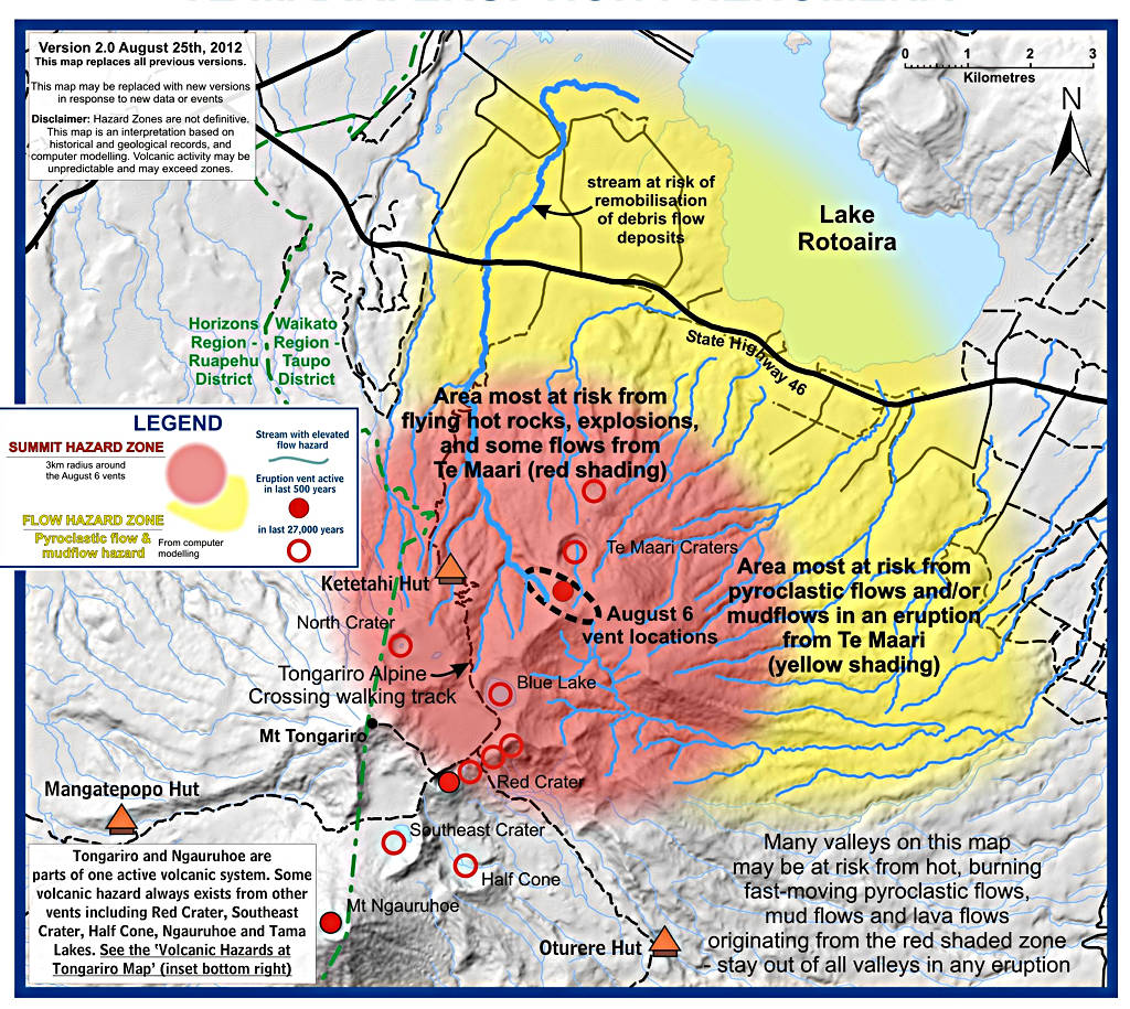
The crossing is a 19+km hike which goes up, around and more or less through the craters of Mt. Tongariro, one of the three active volcanoes in the area. In August 2012 a small eruption from the Te Maari crater rained ash and blocks up to 1m in diameter on the trail and damaging the Ketetahi Hut 1.5km west to the west.
|
|
| Te Maari Eruption Map
Courtesy NZ DOC |
I decided the best way to cope with all the people was to go against the normal flow of traffic. If there's one thing I can't stand, it's hiking in a line of people. There're few things more annoying than staring at some unknown person's butt while you try to figure out a way to pass when they're insensitive to the sound of your feet hitting the ground behind them. A likely situation in todays world of "outdoorsy" people who seem unable to walk anywhere without earbuds and an electronic gadget to drive them.
Going against the grain meant more than an additional thousand meters of elevation gain, but that seemed like a small price to pay for more solitude. We found a campground near the "end" of the walk, checked in for an exhorbitant $44, and inquired of the proprietor about the forecast for the next day. He said it looked good, but was pretty adamant that I was crazy to be walking the wrong direction. He indicated the trail was narrow and not wide enough to pass in most places. That seemed a bit extreme, but I didn't argue.
We pitched our tent, then went over to the community building where we cooked some dinner and said hello to a few of the next day's hordes, mostly young people. We played bananagrams to while away some time, then set our alarm and hit the sack to the sound of a light drizzle. I was not particularly optimistic for the morning's weather.
As dawn approached we could hear people heading out to get an early start. Many people do the crossing who do not have a vehicle, and therefore need to take one of the shuttle buses from the finish of their hike back to wherever the rest of their gear is. The last shuttle departs the finish at something like 5 or 6 pm, and no one wants to be left behind. Others start early simply to avoid the crowds.
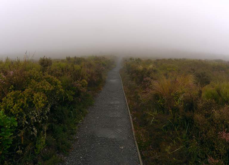
Eventually it was time for us to get up. It was drizzling lightly. We made breakfast, and I decided there was no point in hiking if I couldn't see anything. We packed up and headed out, bummed and looking for something to do.
At one point we were sitting in the car trying to figure out what to do. I scratched my ear and Dona thought it was an earthquake. Honest! It says so right there in my diary. Anyway, we headed up the road to Turangi, a small town on the north side of the park about 10 km from where I was going to start the walk. When we got there we stopped at a New Zealand Department of Conservation office to go to the bathroom. We were checking the exhibits out and happened to see that day's weather forecast on the wall, about an hour old. It said fog and drizzle, clearing around noon, clear in the afternoon, and showers the next day.
I decided to take a chance and go for the hike. We turned around and drove to the trailhead, the end of the hike for those going the "right" way. It was deserted. I shouldered my pack with water, a few snacks, raingear and a few other essentials, said good-bye to Dona, and headed off in a light mist at about 9:30.
The Department of Conservation (DOC) information about the trails in the park says there is no water anywhere, or at least no potable water. So of course right away I was hiking up a creek that looked just fine. I had a filter with me and wondered what the real situation with the creek water was, but since I wasn't dieing of thirst and had a long way to go I didn't stop to try it out.
 |
 |
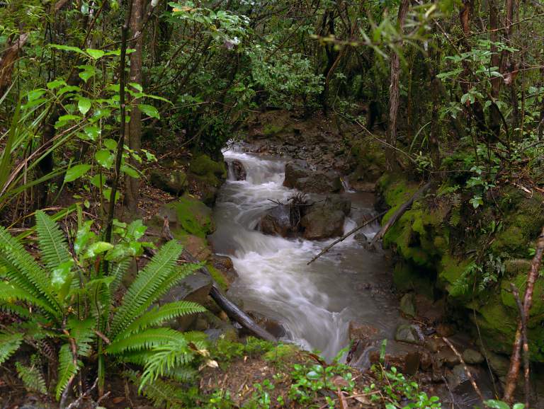 |
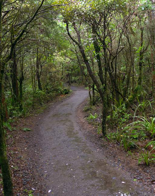
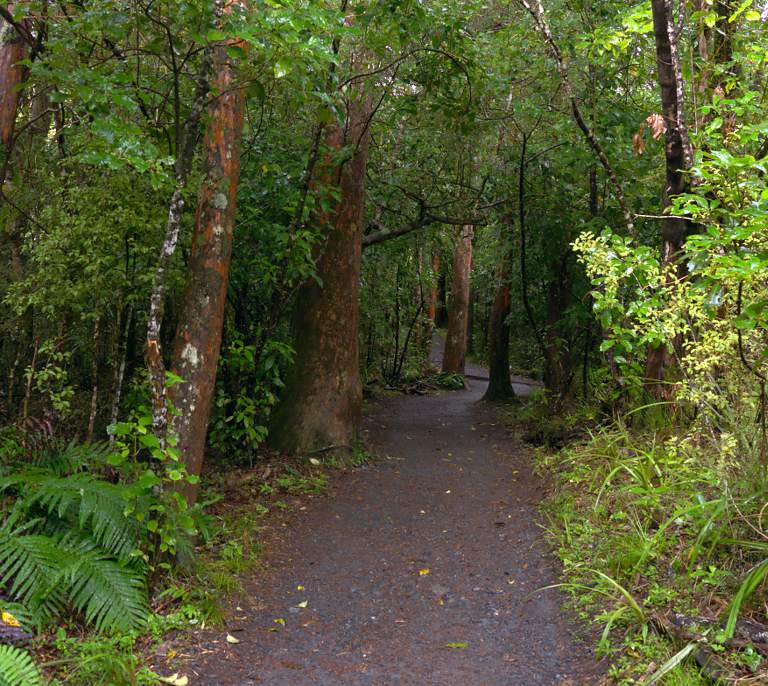
| Start of the (reverse) Tongariro Crossing | Creek | |
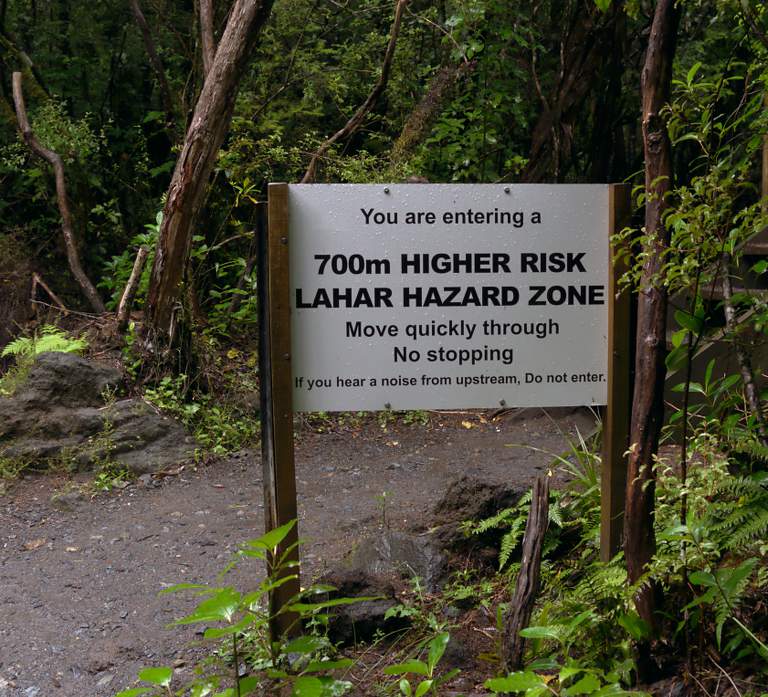
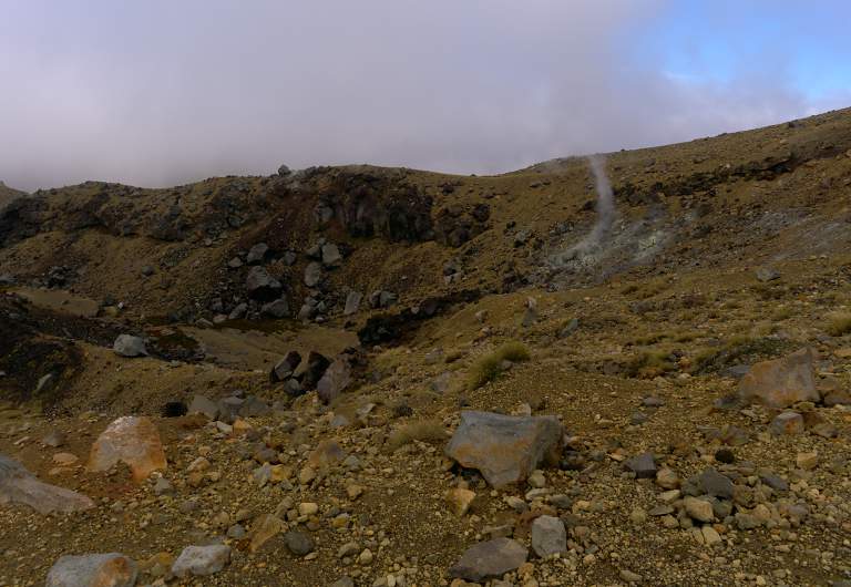
The next thing I encountered was a sign that didn't really make sense; it said "You are entering a 700m higher risk lahar hazard zone." I knew what a lahar was, and I got the gist of the sign; basically it meant "Don't dawdle in this area; the volcano may trigger a lahar at any time and you don't want to be in the bottom of the valley when it comes through." But what the heck is a "700m higher lahar hazard zone?" Did they mean 700m up the mountain is a zone where lahars originate? Or that a 700m high lahar might come through here? In any case, I continued up the trail at my leisurely pace.
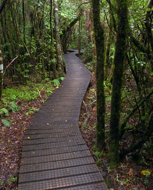
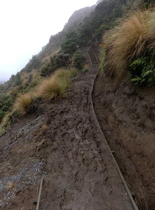
New Zealand trails are in really good shape. The DOC spends a lot of time and money on maintenance, and it shows. It places where it is generally wet, muddy, and consequently slippery, they put down a wire mesh to help hold the dirt in place and give you traction so you don't slip as much. When they build a bridge over some feature, they usually put chicken-wire on top of the boards for the same reason, as shown in the photo below. When there is a steep section, they invariably install steps to make it easier to ascend and descend without slipping.
 |
 |
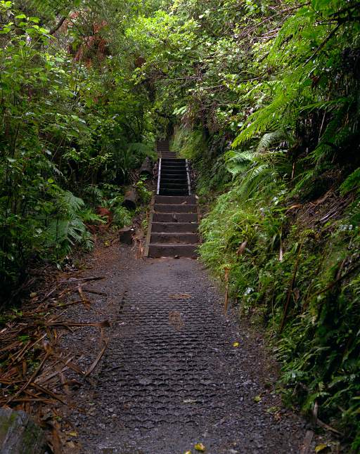 |
| Lahar Zone | Trail reinforcement and Steps | |
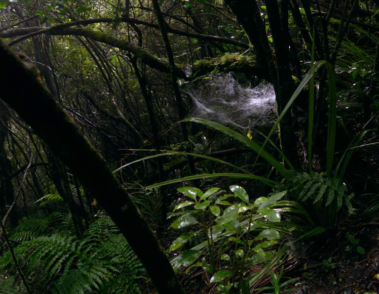
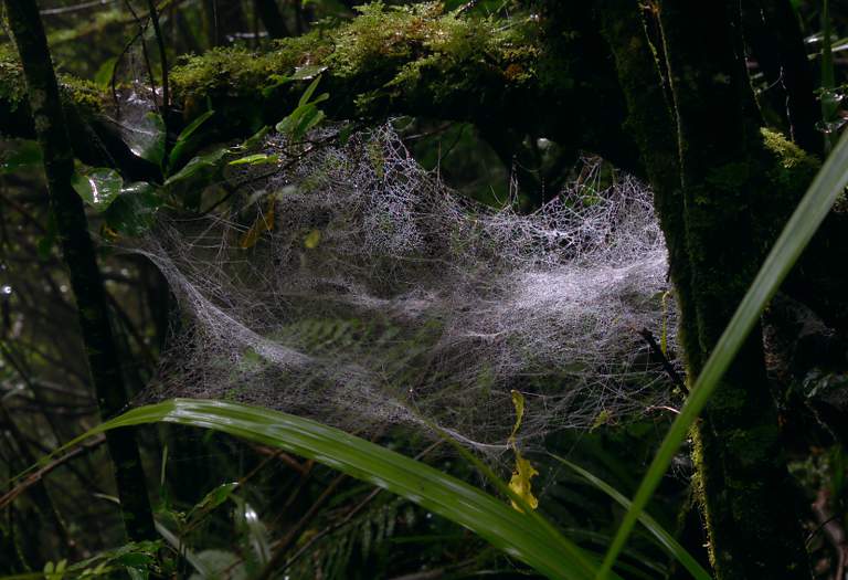
As I was walking through the dark, misty forest I came across several really cool spider webs.
 |
 |
| Spider Web | |
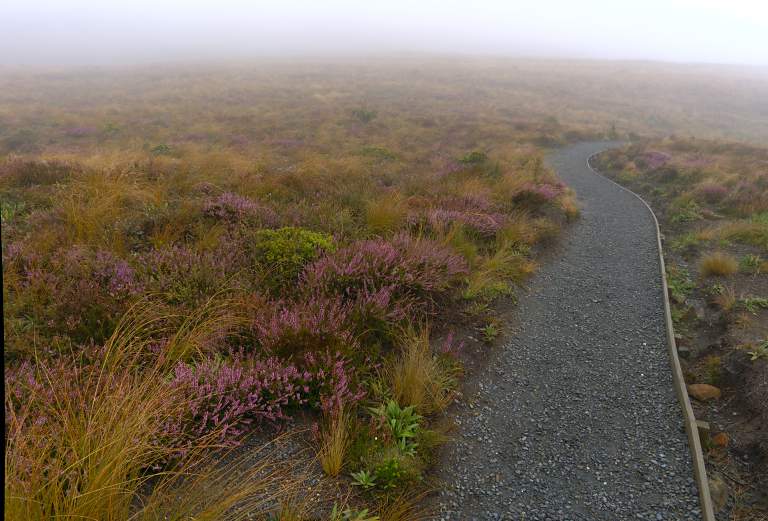
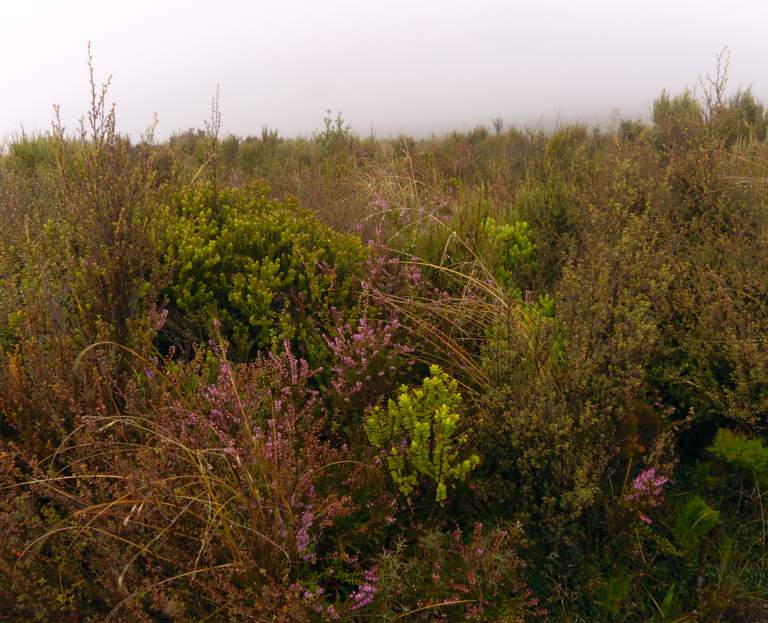
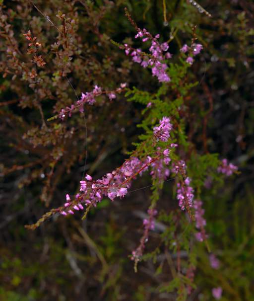
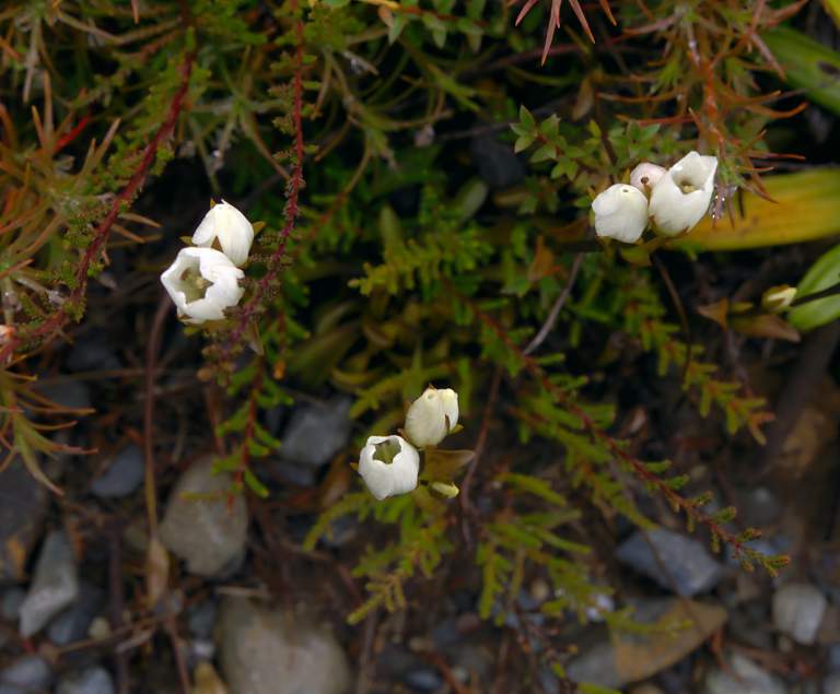
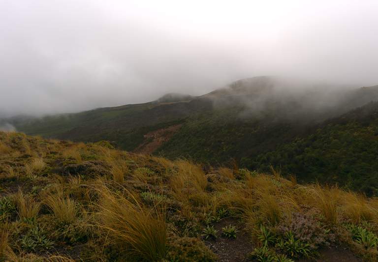
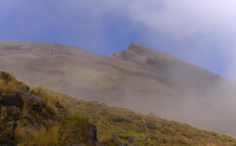
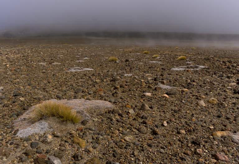
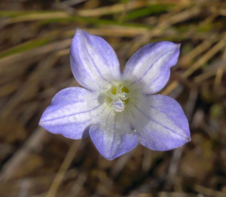
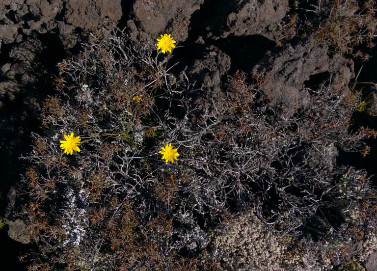
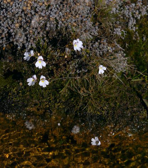
After a bit less than an hour I reached timberline and broke out of the forest. I hoped to see holes in the clouds to indicate clearing weather, but saw nothing encouraging. In spite of that, the expanses of shrubs and heather were fascinating. There were numerous small flowers everywhere, none of which I knew.
 |
 |
| Mist Above Timberline | Heather |
 |
 |
| Heather | |
 |
 |
| Flower Xxx White | Flower Xxx Red |
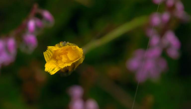 |
| Flower Xxx Yellow |
 |
 |
I had been on the trail an hour and 22 minutes when I was passed by two runners going the same direction as I was. The had been out only 52 minutes and were clearly out to complete the crossing as quickly as they could, rather than to enjoy it.
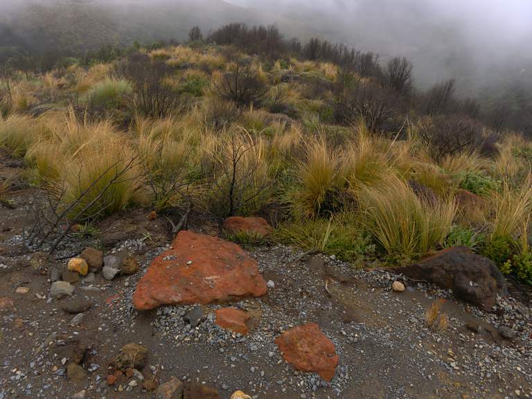
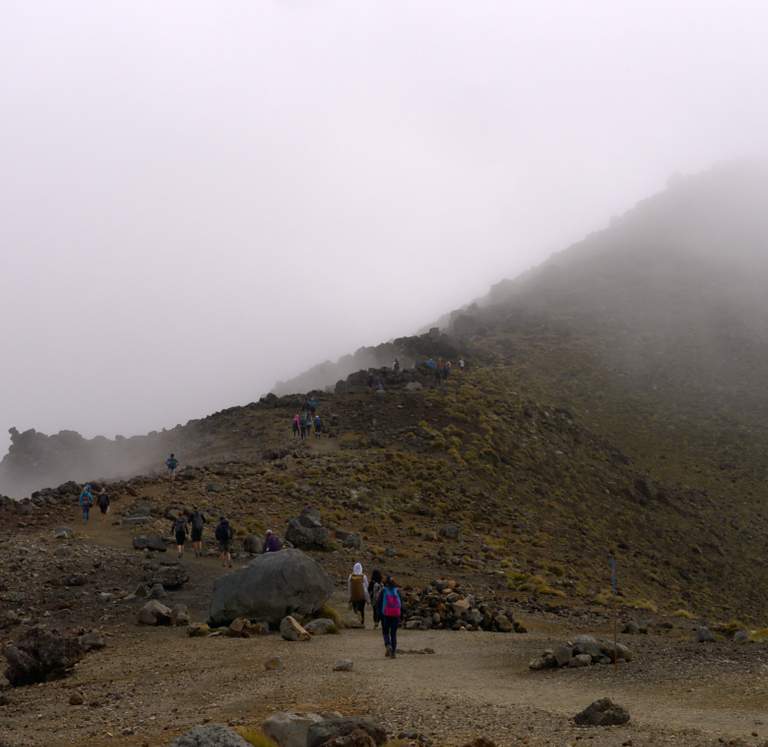
Some ten or fifteen minutes later I started seeing the first of the hordes coming down the trail in the other direction. They had started early to avoid the crowds and had succeeded. But they had hiked the whole way in a fog, and hadn't had a chance to enjoy the journey.
 |
 |
| Trail Mud | Orange Rocks |
As I worked my way up the mountain, switchbacking back and forth, I came across a fenced off hole in the ground. It was an impact crater, and was being preserved to turn it into an interpretive area. I presume the impact was from some kind of ejecta from the volcano, although it just looked like a hole in the ground to me.
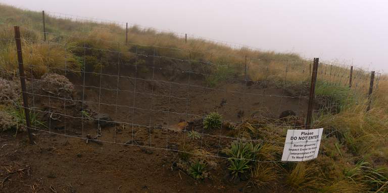 |
| Impact Crater |
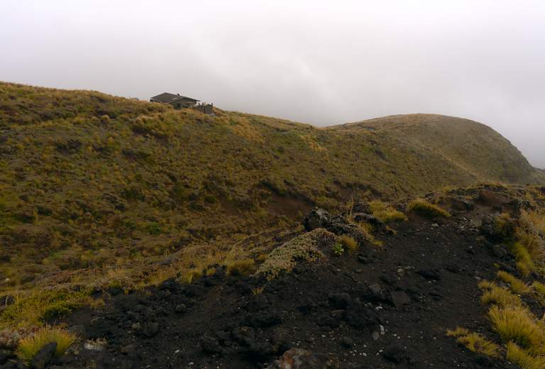
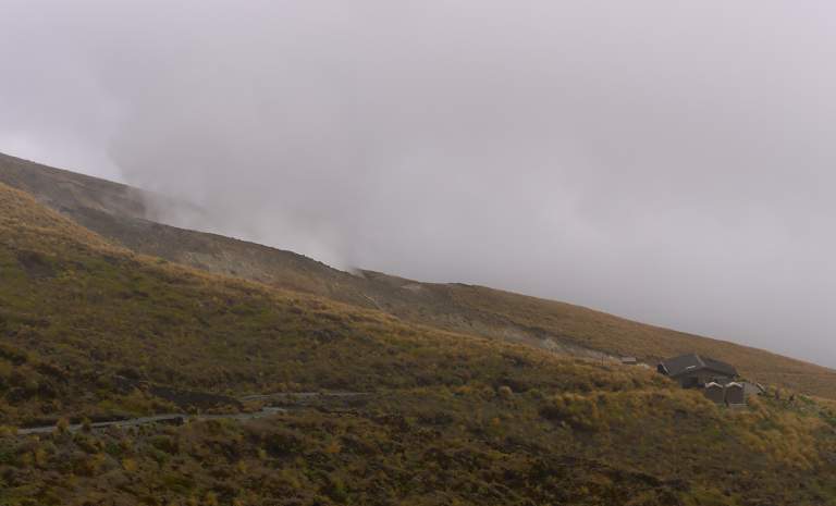
I arrived at the Ketetahi Shelter; it was stuffed with young people passing the time, and they seemed reluctant to leave. It wasn't clear to me whether they were going up or down. I got out a chocolate bar and passed it around, drank some water, rested a few minutes, used the outhouse, and headed on.
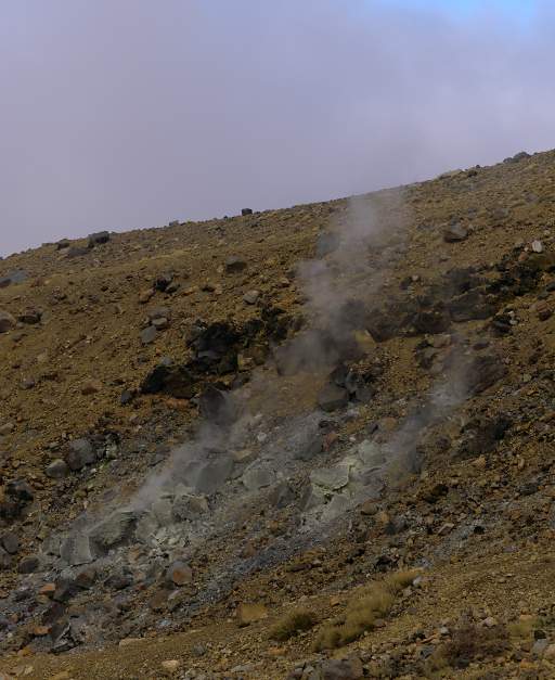
To the west of the shelter is Ketetahi Hot Springs. From the trail it just looks like a big steam vent. It's on private ground and you're not supposed to visit it. Apparently it is owned by the Tuwharetoa indigenous people and they set it out of bounds after a tourist was scalded to death in the 1990s.
 |
 |
| Above Ketetahi Shelter | Ketetahi Hot Springs |
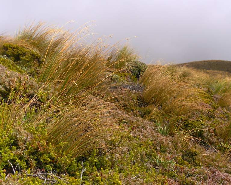
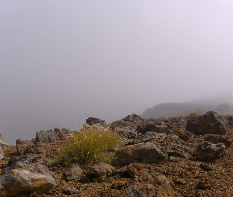
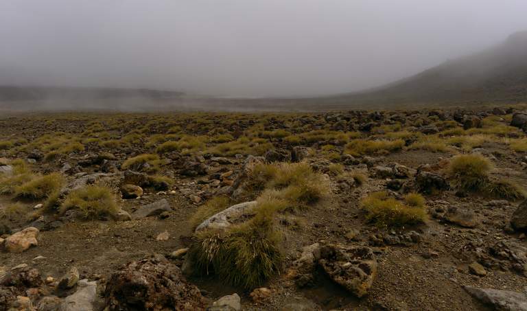
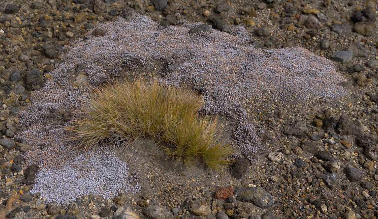
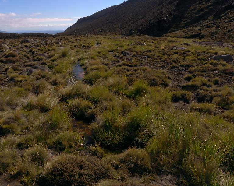
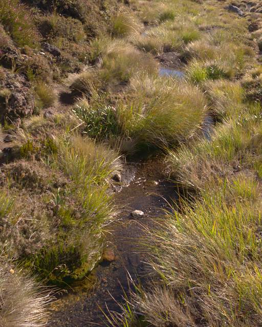
Despite the harsh volcanic environment there was quite a bit of tussock-like grass, heather and other plants growing everywhere. Everything was wet, either from recent rain or just condensation from the clouds. The grass had water droplets on it that would have sparkled had the sun shown.
 |
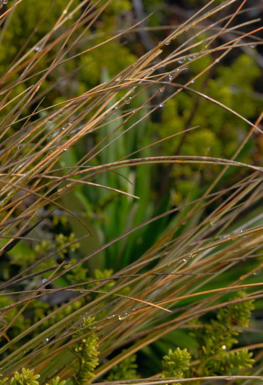 |
| Grass | Water Droplets |
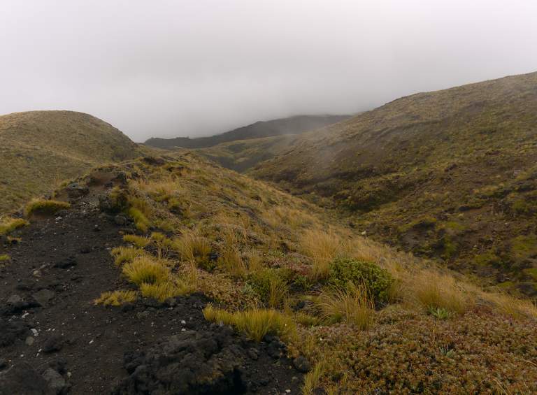
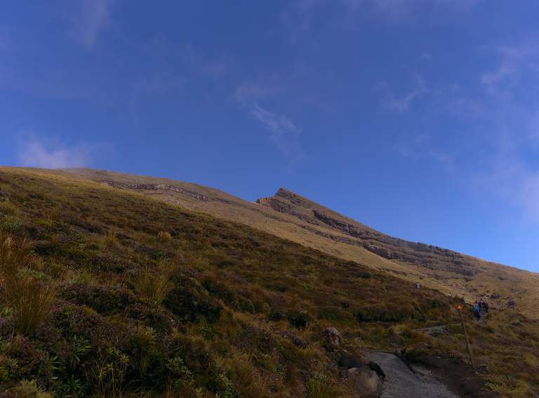
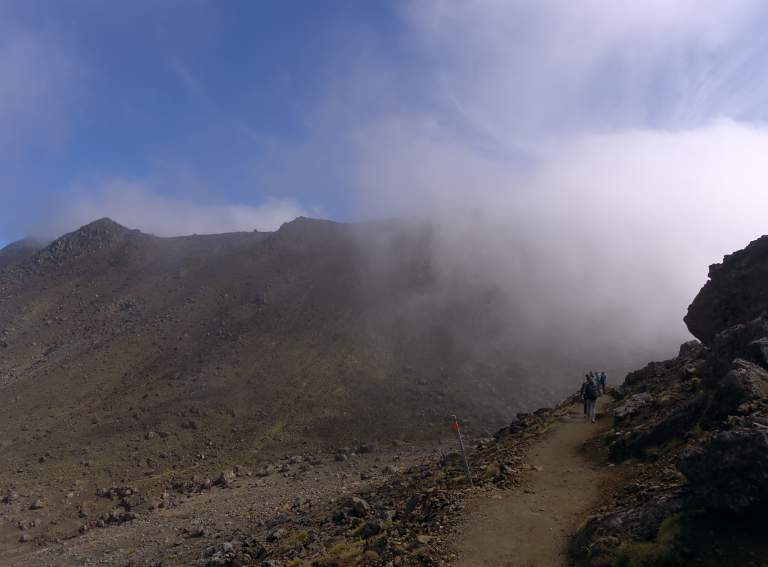
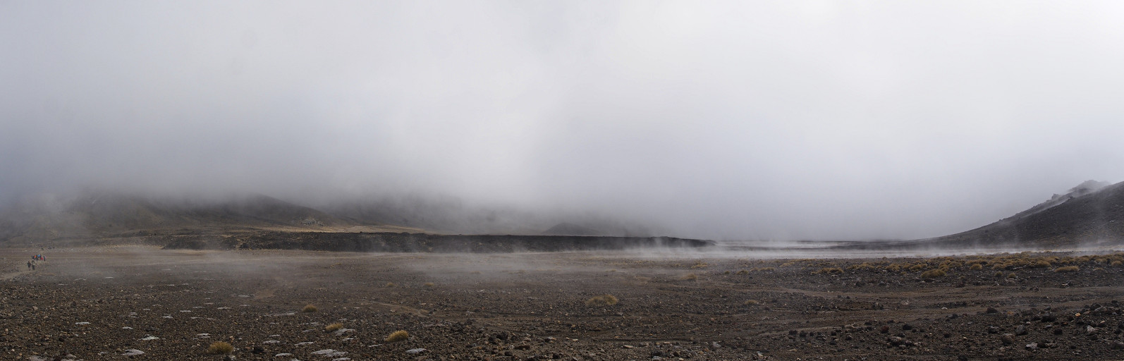
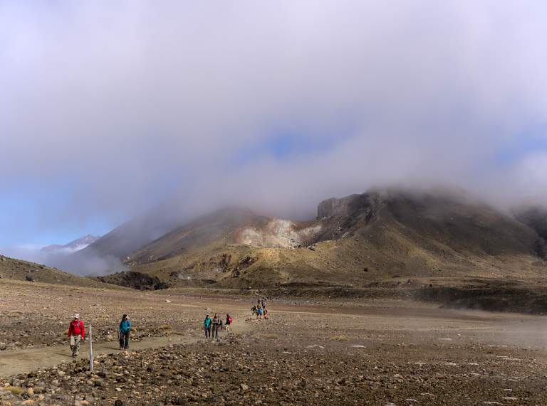
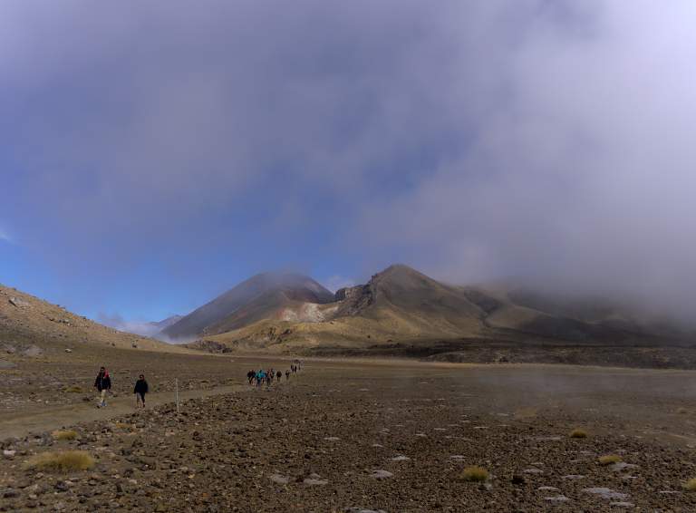
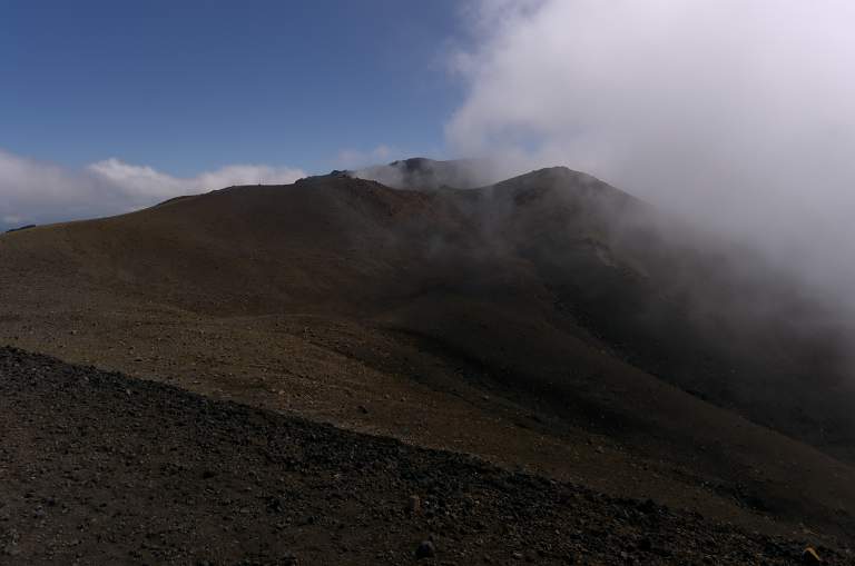
As I continued on up the trail, I started seeing occasional patches of blue sky — the clouds were finally starting to burn off! My mood improved but I kept my pace down, wanting the fog to burn off enough to enjoy the views. People started streaming by, coming at me like a concert or a ball game had just ended. As I walked in and out of the mist, I got a glimpse of Mt. Ngauruhoe and the Central crater.
 |
 |
 |
 |
| People Ahead In Mist | Glimpse Of Ngauruhoe and Central Crater |
 |
| Central Crater |
When I first got a glimpse of Mt. Ngauruhoe and Central Crater I heard a dull thumping sound; eventually I realized it was a helicopter on the far side of the Crater. I looked through my binoculars but couldn't figure out what they were doing. Some hours later when I had walked farther along I saw they had been near the trail; I couldn't see any work they had been doing. Maybe it was a medical evacuation. In any case, they left after a while and peace returned to the volcanoes.
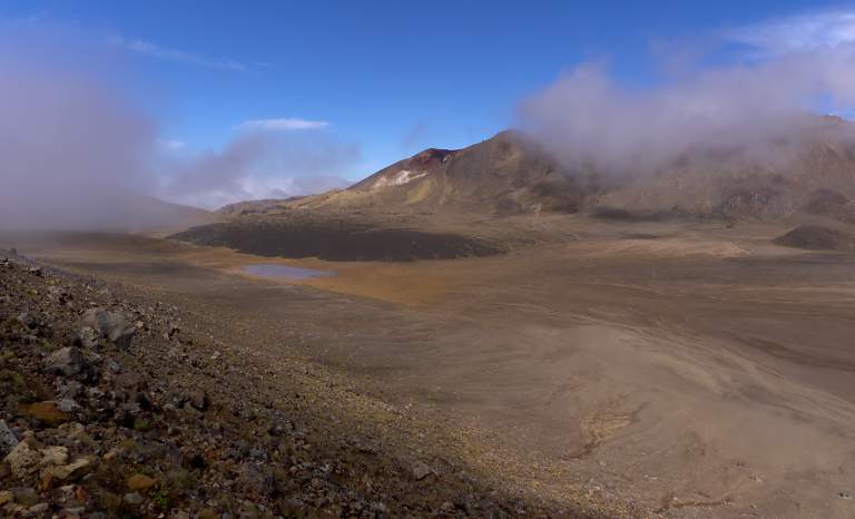
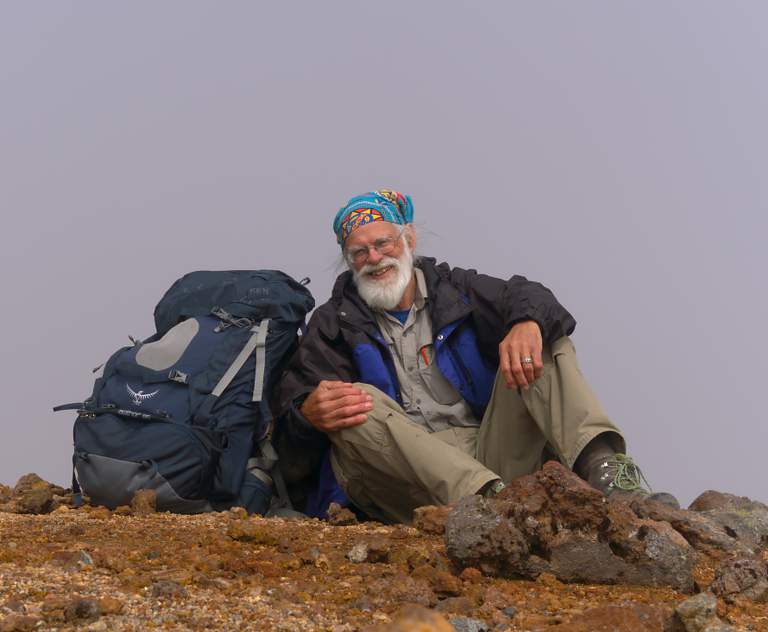
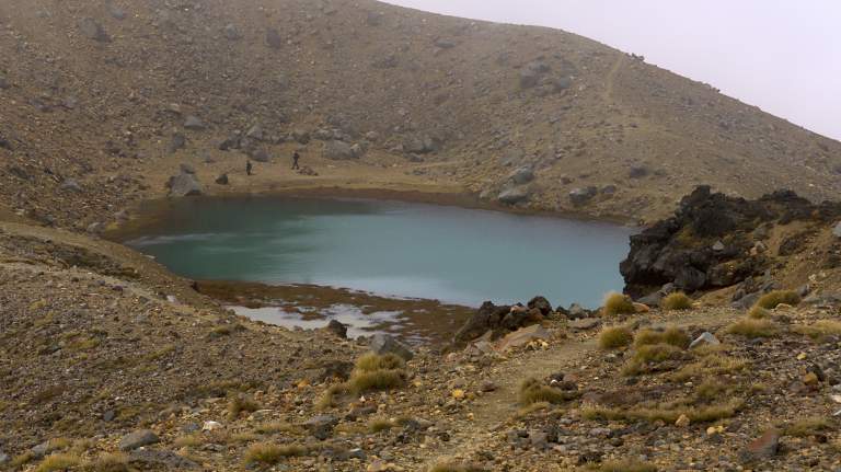
I came to Blue Lake but it was still hiding at least partially in the clouds and mist, so I sat down and waited for a half hour or so. I finally gave up and moved a little bit further on, but then decided to just wait. I moved off the trail a short ways and sat down and just watched the clouds and mist come and go. It was strange and felt like I was on another planet. When the clouds would clear a bit I could see a lunar landscape, nothing but rock and volcanic remains. A man from Bejing, China came and sat nearby. He had his camera out and was waiting too. We said hello but couldn't communicate very well; his English was limited and my Chinese is non-existant. But we were both enjoying the world unfold before us while literally hundreds hurried past a few dozen meters behind us, heads down, earbuds in, marching on to reach the end so they could check off another achievement. In the over two hours I was waiting hundreds passed and only two even slowed down to look around.
 |
| Blue Lake |
 |
| Gary |
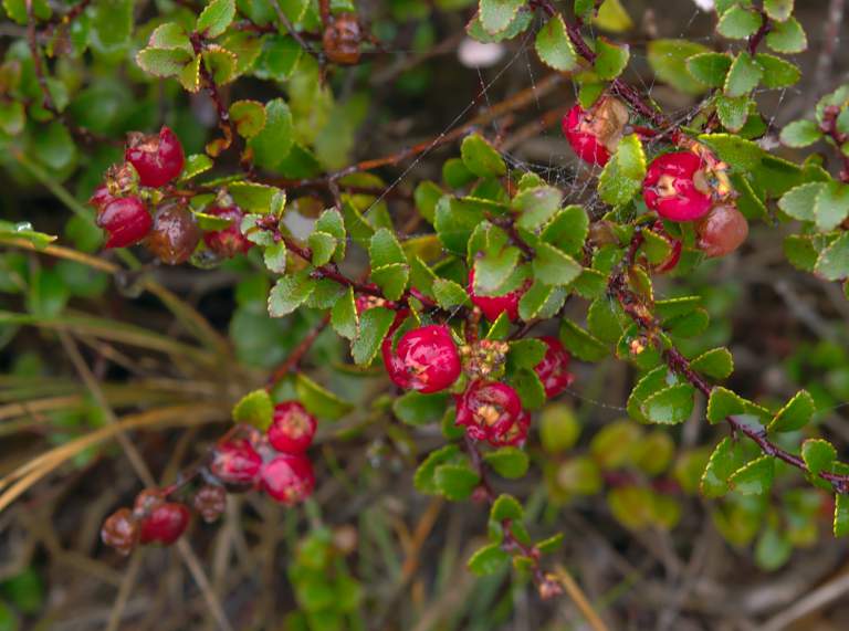
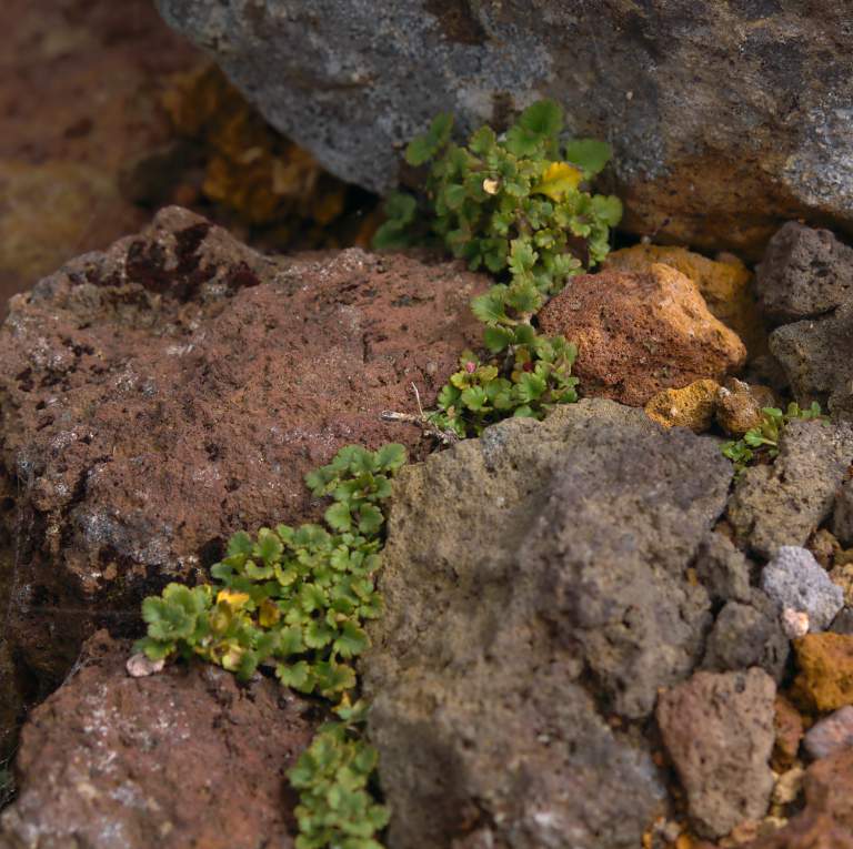
I am always impressed how hardy plants scratch out a living in harsh climates, and noticed grasses growing here and there amid the volcanic rocks.
 |
 |
| Grass | Grass and Pilgrims |
 |
| Xxx Plant |
 |
| People |
I waited for over two hours; eventually the man from Bejing decided he had to move on, probably to make sure he caught the last shuttle bus from the Ketetahi trailhead. Finally I too decided I couldn't wait forever. I wandered on down the trail, into the bottom of the Central Crater.
 |
| Lava Pan and Grass, Central Crater |
 |
 |
| Grass Xxx, Central Crater | |
 |
| Central Crater |
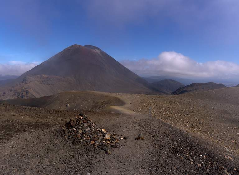
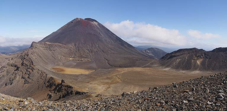
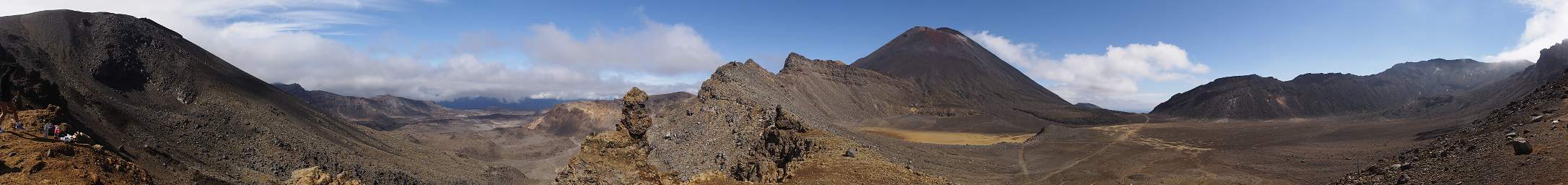
Finally, as I was heading across the Central Crater and the last of the day's hordes was passing, it started to clear. I could see Mt. Ngauruhoe in the near distance, an imposing hunk of earth rising up behind the rim of the Central Crater.. I realized I still had some climbing to do, up and over the rim.
 |
 |
| Mist Clearing, Central Crater Rim with Mt. Ngauruhoe behind | |
 |
| Mt Ngauruhoe and Central Crater Rim |
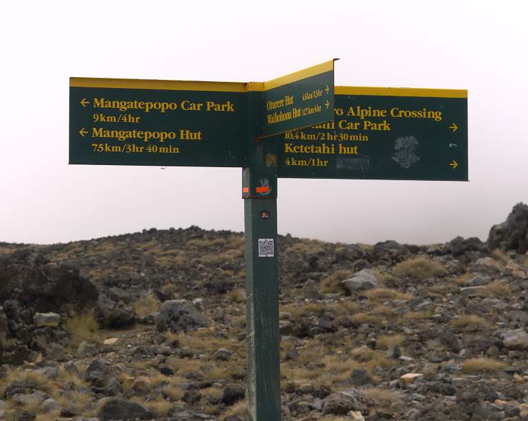
I came to a trail sign that said I still had 9 km to go and it should take me 4 hours, so I thought maybe I should mosey along. It said I had come 10.4 km. Dona and I had agreed she would meet me at the other end; but neither of us had a clue when I'd get there when we parted.
 |
| 9 km to go |
I passed a steam vent and came to Emerals Lakes, a set of small ponds of aquamarine color.
 |
 |
| Steam Vent | |
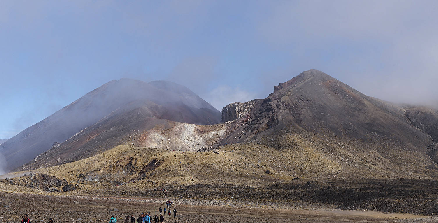
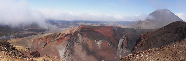
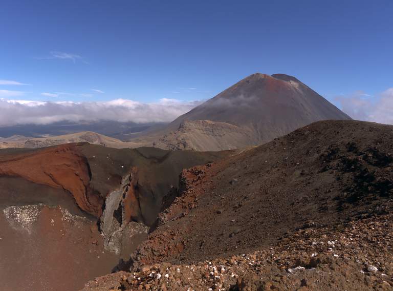
As I reached the Central Crater rim I had an incredible, other-worldly view. I was looking down into Red Crater, and behind it Mt. Ngauruhoe towered with an imposing presence. There were steam vents spread around, and what looked like a vast empty volcanic plain beyond. It was a scene from another planet.
 |
 |
| Emerald Lks | |
 |
| Red Crater and Mt Ngauruhoe |
 |
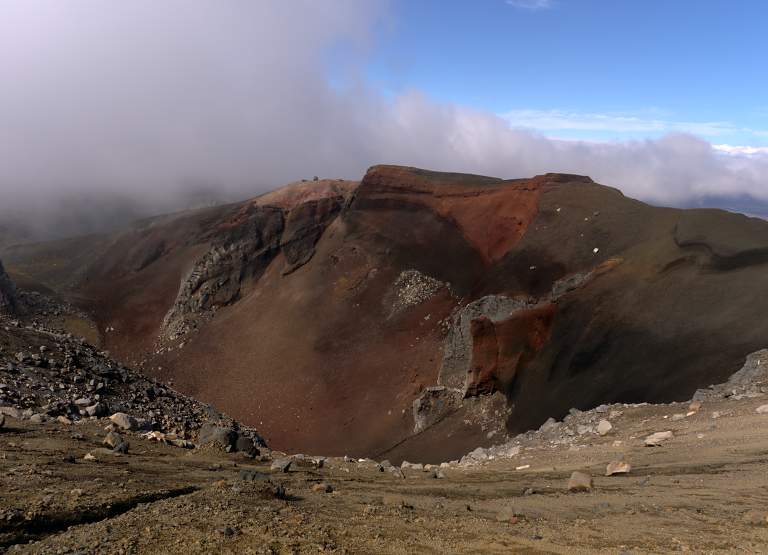 |
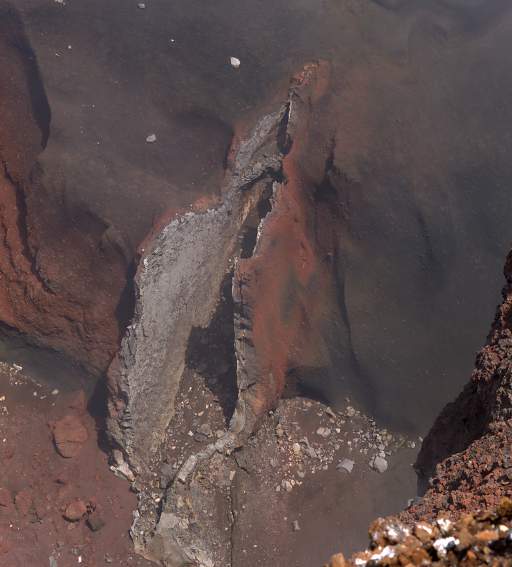
| Red Crater | |
When I reached the high point on the crater rim another track split off to climb to the summit of Mt. Tongariro itself. I thought about doing that but the summit was still engulfed in clouds so I decided against it. In hindsight, I should have gone; I had the time, and what did I have to lose?
 |
| Mt Tongariro |
 |
 |
| Mt Ngauruhoe | Mt Ngauruhoe, Red Crater in foreground |
 |
| Mt Ngauruhoe |
 |
| Mt Ngauruhoe panorama |
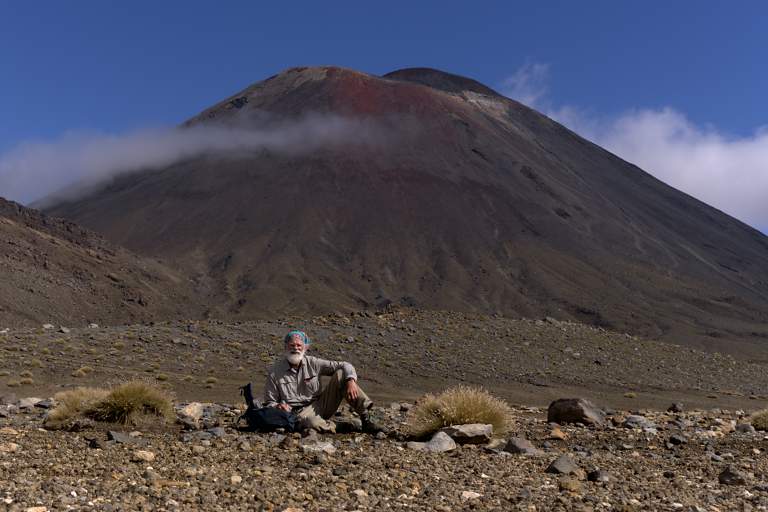
I left the high point of the crossing at 14:48, descending into the crater below Mt. Ngauruhoe. As I reached its floor I kept lookint to Mt. Ngauruhoe, trying to estimate how long it would take to climb to the top from where I was. I didn't know if there was a semi-trail up to the summit or if it is just a free-for-all mad scramble; in any case it looked like it would take some hours. In the end, I decided to forego the opportunity. Again, in hindsight, I wish I had gone. I was concerned that Dona would be waiting at the trailhead and get worried if I was overly late.
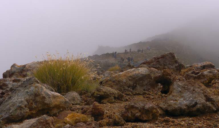
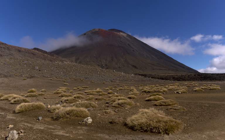
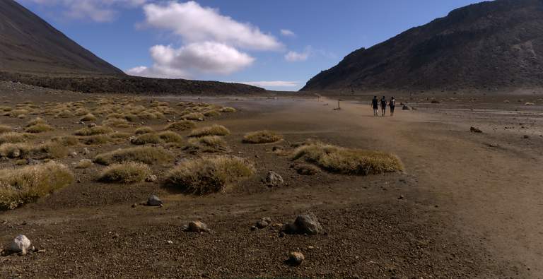
The crater floor was flat as a pancake almost, but not nearly as stark and forbidding as the Central Crater. There were no noticeable steam vents and there were large expanses of some kind of tussock grass. I sat down to watch the world go by and let the few people going my direction wander on out.
 |
 |
| Gary below Mt. Ngauruhoe | Mt. Ngauruhoe, Tussock Grass |
 |
| Grass |
 |
| Trail People |
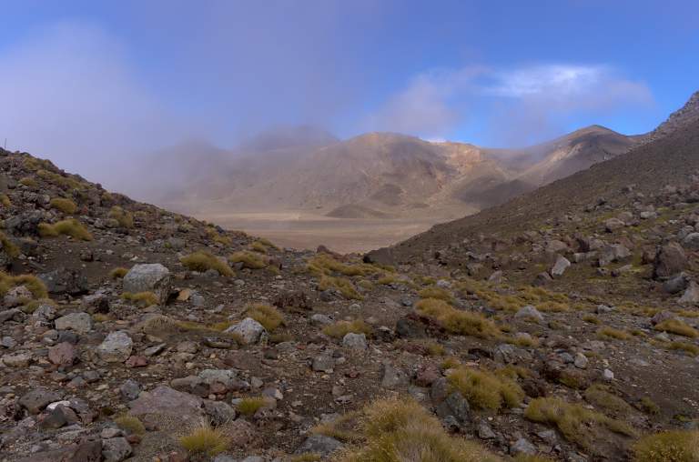
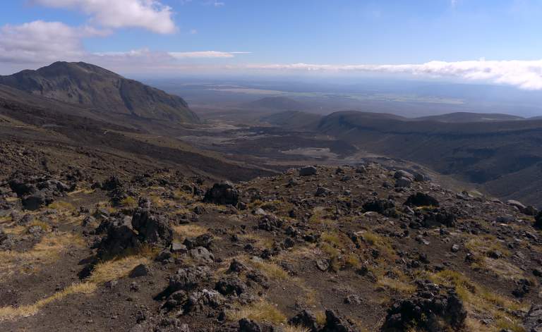
I crossed the crater to the other side, then headed down into the Mangatepopo Valley. From the rim, it is a spare and forbidding landscape, but as you get lower life starts popping back into view.
 |
| Mangatepopo Valley |
 |
 |
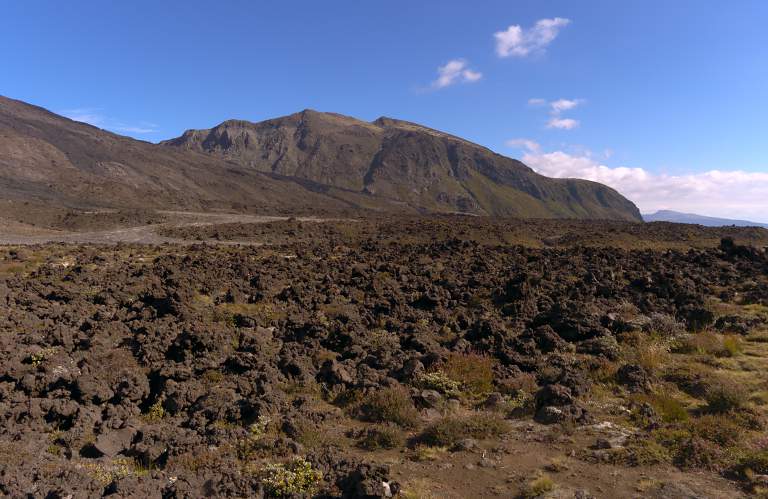 |
| Stream and Grass | Lava | |
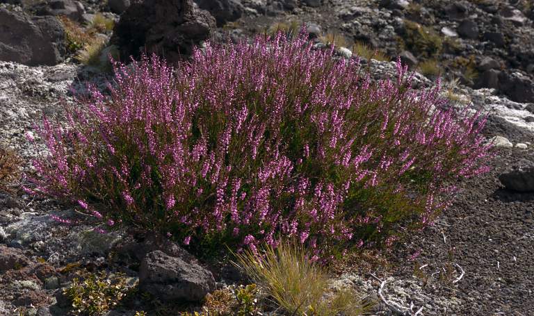 |
 |
| Heather | Flower Xxx Blue |
 |
 |
| Flower Xxx Yellow | Flower Xxx White |
 |
 |
| Mt Ngauruhoe Heather | |
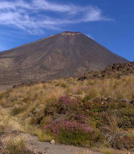
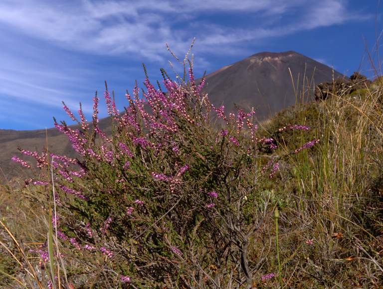
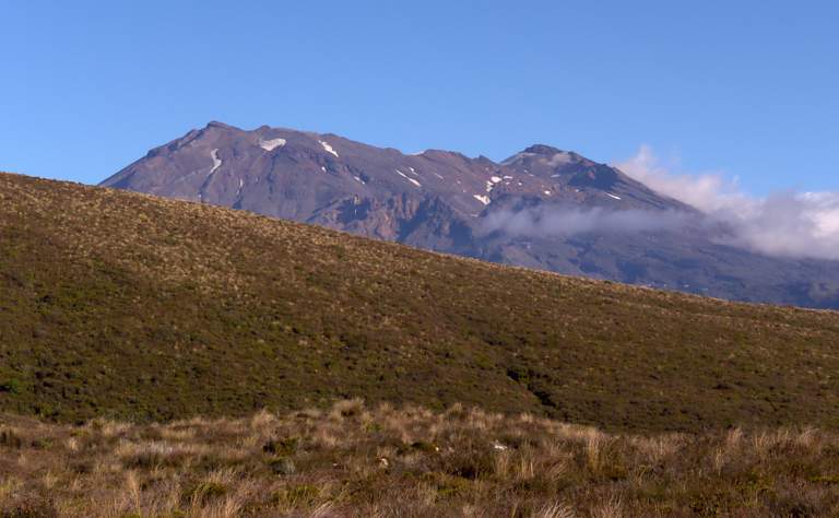
As I neared the trailhead and the end of my day's journey, Mt. Ruapehu came into view. Shortly afterwards I saw a familiar figure hiking up the trail towards me. Dona had had an enjoyable day hiking on Mt. Ruapehu, and was surprised to see me so soon. Dangit! I could have climbed Ngauruhoe...
 |
| Mt. Ruapehu |
Meanwhile... over on Mt. Ruapehu...
This page last updated on 2016-12-01.
![]()